Wettest recorded at this site - also colder than average.
The run of poor months continued in September which apart from being slightly colder than average was also the wettest yet recorded at this site. Rain fell frequently, sunshine was limited and consequently there was no warmth during the month; indeed this is the first September in my records which has failed to attain 20°c - and whilst not unusual for September, we also had the ground frost of the season.
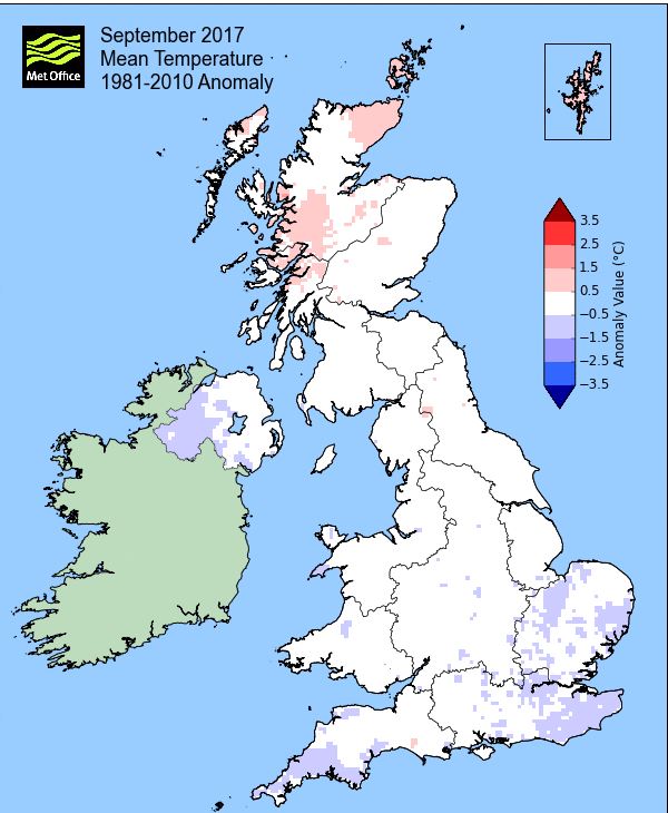
And like August, it was the mean maximum temperature that showed the greater departure from the norm', being 1°c below average and with the month opening with two fairly decent and sunny days, it really was downhill from there on in!
There was a fairly constant stream of low pressure systems arriving from off the Atlantic, especially during the 4-13th, which resulted in the month's average rainfall having fallen by the 15th. Rainfall remained frequent, but not especially heavy thereafter, until the end of the month which ended wet and the ground reaching saturation.
The middle of the month became cooler under a NW'ly flow as we sat to the east of high pressure in the Atlantic and during which that ground frost was recorded. As the month then reverted back to type (unsettled), temperatures recovered slightly under the influence of a southerly flow, but without the sunshine to accompany it.
In what was a fairly subdued month, there were no days of thunder, fog, gales, etc.
MSLP of 1010.3 Mb was -3.8 Mb below the local average for September with low pressure systems a regular feature, although winds from a SE'ly and NW'ly quarter were more prevalent than those from the SW - needless to say that apart from the first two days, high pressure never became established and was confined to the occasional weak ridge.
Overall a mean minimum of 8.38°c and a mean maximum of 15.75°c saw the temperature 0.2°c below the 1981-2010 average. It was the coldest since 2015 and of the nine now recorded, 6 have been warmer and 2 colder. The highest maximum temperature recorded was 19.9°c (24th), the lowest minimum 0.6°c (19th).
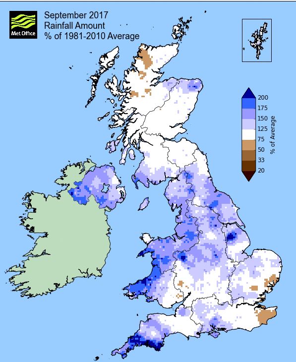
Rainfall of 139.5 mm (Crosby Ravensworth School 148.5 mm - Castlehowe Scar 188.5 mm - Reagill ??? mm) made it the wettest September yet recorded at this site (of the 11 now recorded) and was 179.3% of average for 2007-16.
Locally, rainfall percentages were well above average, particularly across the Lake District, but also in the east of the county.
At the Met' Office site at Newton Rigg, 114.8 mm (150.5%) made it the wettest September since 2000 and in a series back to 1900 September has been drier in 101 years and wetter in 14 years (2yrs of missing data). A mean temperature of 11.75°c is the coldest since 2015 and in a series back to 1951, 18 have been colder, 45 have been warmer and 3 have had the same mean temperature.
Figures from the Environment Agency�s rainfall sites were, (figure in brackets being the monthly average for 1961-90) �Data kindly provided by the Hydrometry and Telemetry team of the Environment Agency (Penrith)�:
Kirkby Thore 15.8 mm (69.7 mm)
Haresceugh Castle (Kirkoswald) 94.78 mm (88.1 mm)
Brothers Water 312.97 mm (243 mm) and
385.8 mm at Seathwaite Farm (Borrowdale - 270 mm [average for 1981-2010])
1st - 3rd Autumn opened with the Azores High ridging strongly over the UK which ensured a spell of decent sunny weather.
Pleasant was the theme, cool by night, sunny and respectfully warm by day. Both the 1st and 2nd saw the minimum temperature dip below 4°c, but both just avoided a ground frost. The 2nd fell to a low 3.1° with a ground minimum of 0.4°c with the 1st being the warmest day of the two at 18.0°c.
Low pressure (LP) had been making slow progress east during this time and would now arrive, however, the 3rd would only see overcast skies and just a few spots of rain late in the day.
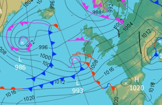
4th - 13th Downhill from this point to well into the month as a succession of LP systems brought cooler, unsettled and wet conditions.
Each area of LP would control the weather for 2-3 days with very short transitional periods inbetween the systems and which included the first named storm of the season (Aileen 12-13th), although for ourselves the weather was actually worst during the 10-12th.
The first system controlled the 4-6th with the temperatures dropping down to 14.7° by the 6th, but with the cloudy skies night-time minima rose into double figures. The 4th with 7.7 mm of rain was the wettest day during this time.
The next system brought heavier rain, 8.8 mm on the 7th was followed by 10.4 mm on the 8th. However, the 7th was probably the worst of the two days which had rain or drizzle throughout, whilst the 8th was mainly dry throughout the daylight hours, its rain falling in the evening and overnight into the 9th.
The next area of LP moved through more quickly giving a mixed bag (but mainly of rain), on the 10th. The rain was at its heaviest overnight into the 11th to give 14.8 mm (credited back to the 10th). The 11th was then showery as the LP cleared the UK to the east.
Then finally this unsettled period was brought to an end by Storm Aileen which brought a spell of heavy rain, but due to its track across the UK being to our south it was one that really did not affect Cumbria. The 12th even saw sunny intervals before the rain arrived during the evening, becoming heavy for a while overnight before dying out.
This gave 21.0 mm of rain credited to the 12th making it the month's wettest day and was followed on the 13th by showers and sunny spells. Aileen really had no impact on us at all, the winds had been stronger on the 10th and the pressure (978.5 MB) on the 11th lower. However, the temperatures were suppressed, now falling below 15°c.
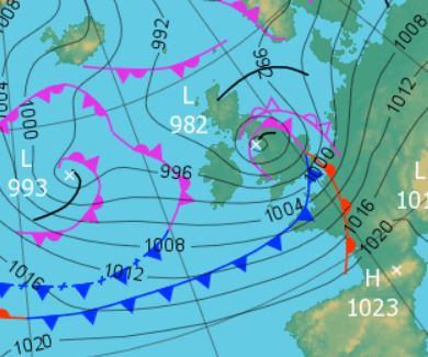
14th - 19th High pressure (HP) then built in the mid Atlantic but did not extend far enough to sit over the UK. This resulted in a cooler and showery phase, although with sunny spells and under the influence of a NW'ly flow.
The days were reasonable with sunny intervals, but with the odd rogue shower, some of which were heavy. However, with that NW'ly flow the temperature was cool, falling away to 12.8° (55°f) on the 16th and a month's low of 12.6°c (54.7°f) on the 18th.
Through the period the mornings tended to start with some sunshine and not much cloud with the showers coming later in the day.
 1200 Hrs 15th - high pressure in the Atlantic drawing down the cooler NW'ly flow
Under overcast skies and now a more raw northerly wind, the 18th was chilly, but the skies cleared overnight into the 19th and the temperature quickly fell away. Whilst avoiding an air frost at 0.6°c (33.1°f), the month's coldest night, there was however, the first ground frost of the season, -1.1°c (30°f). However, the 19th was the best day of the period, enjoying sunshine throughout, although the temperature only rose to 15.4°c.
20th - 25th Slightly mixed with fronts occasionally giving spells of rain, inbetween which the pressure gradient slackened to give drier, but cloudy days.
The HP gave way on the 20th as LP in the Atlantic tracked north, pushing fronts towards the UK. Overcast until tea-time when the rain arrived to give a wet evening.
The 21st still saw the cold front strung out N-S through the UK giving a drizzly day with the temperature fairly static during both day and night, only ranging from 13.7°c to 14.6°c.
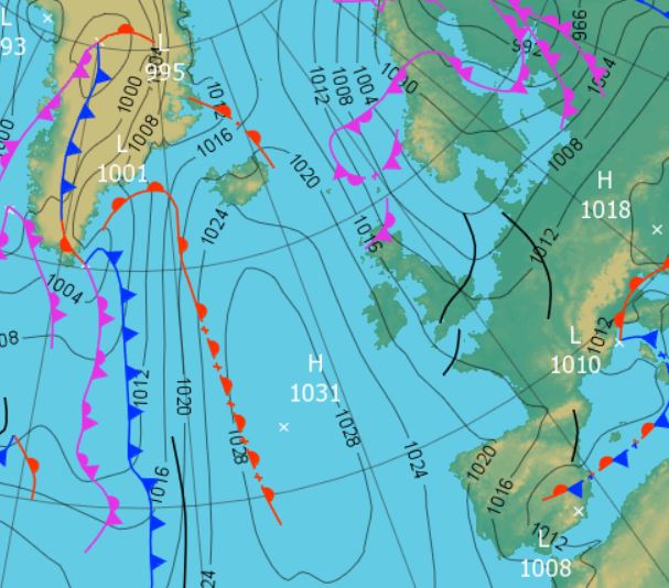
As the cold front finally cleared east the pressure gradient slackened briefly ahead of a new area of LP that would bring drizzle then rain during the evening of the 22nd. A deeper area of LP was in the Atlantic and which would also track north to Iceland. It gave a wet end to the 24th and then a drizzly, overcast day on the 25th that became quite murky.
26th HP over Finland ridged down over the UK on the 26th to gave a dry day with some hazy sunshine.
27th - 30th Through to the month's end daily rainfall totals were high, but there were some spells of sunshine.
Initially LP to the west of Eire would track north, but its frontal system would give 9.9 mm of rain during the evening of the 27th with the 28th a transitional day ahead of an even deeper area of LP moving quickly across the Atlantic. As transitional days go, the 28th was a decent one with plenty of sun and even the 29th got to see some sun during the afternoon once the fronts had cleared east.
However, the month ended with a wet day as vigorous trough lines circulating on the southern side of the LP, which was now moving north towards Iceland, brought spells of heavy rain. Rain overnight into the 30th gave 12.7 mm (credited back to the 29th) and was followed by spells of heavy rain during the morning and into mid afternoon, accounting for another 16.0 mm - and then the sun came out.
Rainfall totalled 139.5 mm for the month, with rain recorded on 23 days of which 21 were 'Wet days' (1.0mm +).
The Mean Temperature for the month was 12.06°c -- The Mean Max' was 15.75°c -- The Mean Min' 8.38°c.
We had 0 Air Frosts in the month (year 32) -- Grass frosts totalled 1 (year 68).
The 1 foot soil temp ranged from a low of 12.3°c on the 20th to a high of 14.7°c on the 5th -- with a monthly mean of 13.6°c
The 1 meter soil temp ranged from a low of 12.6°c on the 25th to a high of 14.1°c on the 1st -- with a monthly mean of 13.2°c
COMPARISONS:-
* September 2017 rainfall was 19.3% of the average for 2007 - 2016
* September 2017 was 0.56°c colder than the average for 2009 - 2016 and 0.2°c colder than the local long term average 1981-2010
* This makes the Jan' to September period of 2017 some 0.62°c warmer than the average for 2009-16 and with 94.1% of average rainfall for 2008-16
JANUARY 2010
FEBRUARY 2010
MARCH 2010
APRIL 2010
MAY 2010
JUNE 2010
JULY 2010
AUGUST 2010
SEPTEMBER 2010
OCTOBER 2010
NOVEMBER 2010
DECEMBER 2010
JANUARY 2011
FEBRUARY 2011
MARCH 2011
APRIL 2011
MAY 2011
JUNE 2011
JULY 2011
AUGUST 2011
SEPTEMBER 2011
OCTOBER 2011
NOVEMBER 2011
DECEMBER 2011
JANUARY 2012
FEBRUARY 2012
MARCH 2012
APRIL 2012
MAY 2012
JUNE 2012
JULY 2012
AUGUST 2012
SEPTEMBER 2012
OCTOBER 2012
NOVEMBER 2012
DECEMBER 2012
SUMMER 2012
REVIEW OF 2012
JANUARY 2013
FEBRUARY 2013
MARCH 2013
APRIL 2013
MAY 2013
JUNE 2013
JULY 2013
AUGUST 2013
SEPTEMBER 2013
OCTOBER 2013
NOVEMBER 2013
DECEMBER 2013
REVIEW OF 2013
JANUARY 2014
FEBRUARY 2014
MARCH 2014
APRIL 2014
MAY 2014
JUNE 2014
JULY 2014
AUGUST 2014
SEPTEMBER 2014
OCTOBER 2014
NOVEMBER 2014
DECEMBER 2014
WINTER 2014
REVIEW OF 2014
JANUARY 2015
FEBRUARY 2015
MARCH 2015
APRIL 2015
MAY 2015
JUNE 2015
JULY 2015
AUGUST 2015
SEPTEMBER 2015
OCTOBER 2015
NOVEMBER 2015
DECEMBER 2015
REVIEW OF 2015
JANUARY 2016
FEBRUARY 2016
MARCH 2016
APRIL 2016
MAY 2016
JUNE 2016
JULY 2016
AUGUST 2016
SEPTEMBER 2016
OCTOBER 2016
NOVEMBER 2016
DECEMBER 2016
REVIEW OF 2016
JANUARY 2017
FEBRUARY 2017
MARCH 2017
APRIL 2017
MAY 2017
JUNE 2017
JULY 2017
AUGUST 2017
OTHER ARTICLES
The Oldest Inhabitant
An Inch Of Scotch Mist
© Darren Rogers 2010-17
Want to comment on this site? email